
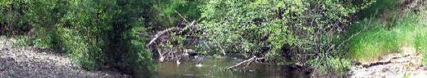
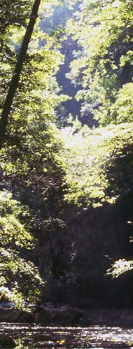
SAN FRANCISQUITO CREEK WATERSHED The San Francisquito Creek watershed encompasses an area of approximately 45 square miles and is located on the eastern flank of the Santa Cruz Mountains, at the base of the San Francisco Peninsula. Most of the San Francisquito watershed is located outside the area covered by the Stanford HCP. This watershed is located in two counties, San Mateo and Santa Clara, and two of its constituent creeks (Los Trancos and San Francisquito) form part of the boundary between the two counties. The San Francisquito Creek watershed has four major subwatersheds located in part on Stanford lands: Bear Creek (Bear Gulch Creek), Los Trancos Creek, San Francisquito Creek, and streams that flow into Searsville Reservoir (including Corte Madera, Dennis Martin, Sausal, and Alambique creeks). During all but the wettest years, significant portions of San Francisquito Creek and its tributaries dry up by mid-summer. The Stanford-owned mid-section of this watershed is characterized by a mix of open space and development. This upper portion of the watershed includes low density residential, commercial, recreational (Stanford Golf Course and equestrian facilities), scientific (Stanford Linear Accelerator and Jasper Ridge Biological Reserve), and agricultural land uses. Downstream from Junipero Serra Boulevard, the watershed is dominated by high-density residential and commercial land uses. Generally, the creeks support a 25- to 75-meter-wide band of riparian vegetation: willows, bay laurels, redwoods, alders, cottonwoods, dogwoods, valley oaks, and coast live oaks. This riparian zone is limited in extent by adjacent land use and topography. Stanford has three functioning water diversion facilities in the San Francisquito Creek system: Searsville Dam and Reservoir, Los Trancos diversion on Los Trancos Creek, and an in-channel pumping station, located in San Francisquito Creek near the Stanford Golf Course. A U.S.G.S. gauging station (11164500) is located on San Francisquito Creek near the Stanford Golf Course, approximately 500 meters south (upstream) of the Junipero Serra Boulevard/Alpine Road intersection. This station has been in operation since the early 1930s. Skippers Pond is the largest natural pond located on Stanford lands. It is situated in the riparian thicket adjacent to Family Farm Road, upstream from Jasper Ridge Biological Preserve. This pond fills naturally with groundwater and run-off, with comparatively little surface flow connection to the nearby creeks (Sausal and Corte Madera). Skippers Pond holds water year-round in some years, but generally dries up by the end of summer in years of average or below average rainfall.
|
& Real Estate